TIBCO Spotfire 6.0 provides built in geocoding for a variety of geographic features including Continent, Country, Province, State and Territory, Prefecture, Region, Department, District, Country, Municipality, City and Postal Code. This allows customers who have location based data with any of the features above to accurately position those locations on a TIBCO Spotfire Map Chart. (to learn more about this geocoding in Spotfire 6, please watch a demo on it here)
However, some use cases will require the need to do street or address level geocoding, which are not included in the supported feature list above. For this solution, TIBCO offers a separate product called GeoAnalytics Builder that includes a Web site and a set of Web Services that can do street and address level batch geocoding.
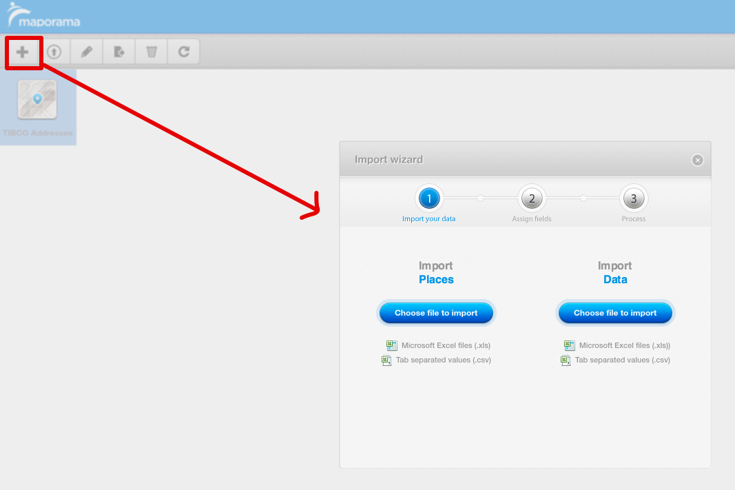
The Web site, http://geoanalyticsbuilder.maporama.com, will allow users to upload .xls files with geographic features, like City, State, Zip, and then it will calculate the latitude and longitude for each row.
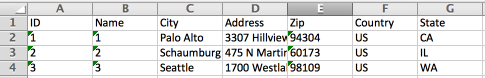
In this example, let’s assume we want to upload location information about various TIBCO addresses. We have a .xls file that contains City, Address, Zip, State, and Country like below:
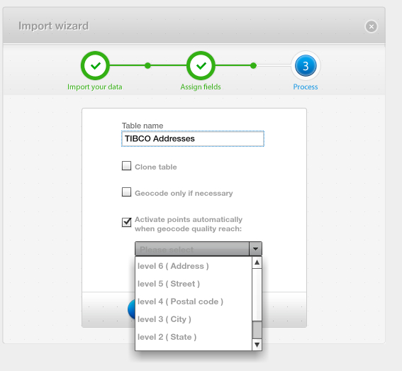
GeoAnalytics Builder will then upload the file, geocode each row , add the latitude and longitude columns and display them on the TIBCO base map:

You can then use the site to validate the coordinates and then export the data , as a .xls file, for use in Spotfire. You can either load this file directly in Spotfire Professional, or you can upload this file to the Spotfire Server so that you can make this geocoding table available to other users who require it (assuming the locations are locations that are useful across multiple analysis files).
In addition to the Web site, GeoAnalytics Builder also provides a set of SOAP and REST APIs which allow you to do geocoding, as well as other calculations. Details of the REST APIs are available at: http://geoanalytics.tibco.com/api/rest/index.html
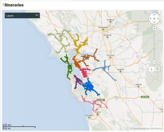
On common use case of the API is to calculate driving distances between various points. If you wanted to do this directly from Spotfire, you could pass the various locations to the Web Service either using something like TERR via a Data Function or via IronPython. The return will be an XML file which we can parse and load as a new Data Table which we can then display as a Feature Layer on a Map Visualization: